Category Archives: Urban Infrastructure

Dwarka Expressway Emerges as a Key Realty Hub in India

Dwarka Expressway Emerges as a Key Realty Hub in India

Introduction

The Dwarka Expressway, once just another infrastructure project on paper, has now evolved into one of India’s most sought-after real estate corridors. Stretching between Delhi and Gurugram, the expressway has emerged as a critical connectivity link and a magnet for residential and commercial investments.

Fueled by improved infrastructure, proximity to the Indira Gandhi International Airport, and strategic location linking Delhi with fast-developing areas of Gurugram, the Dwarka Expressway has become a hotbed for real estate growth, urban migration, and developer interest.

A Timeline of Transformation

Initial Development

  • First proposed in the early 2000s, the Dwarka Expressway faced several delays due to land acquisition and litigation.
  • After years of roadblocks, construction gained momentum around 2018–2019.

Inauguration and Current Status

  • As of 2024, the expressway is largely operational, with the final stretches being completed.
  • It connects Dwarka (Delhi) to Kherki Daula (Gurugram) over a stretch of 29 kilometers.

What Makes Dwarka Expressway a Realty Hotspot?

Seamless Connectivity

  • Direct link between Delhi, Gurugram, and Manesar.
  • Proximity to IGI Airport and upcoming India International Convention Centre.
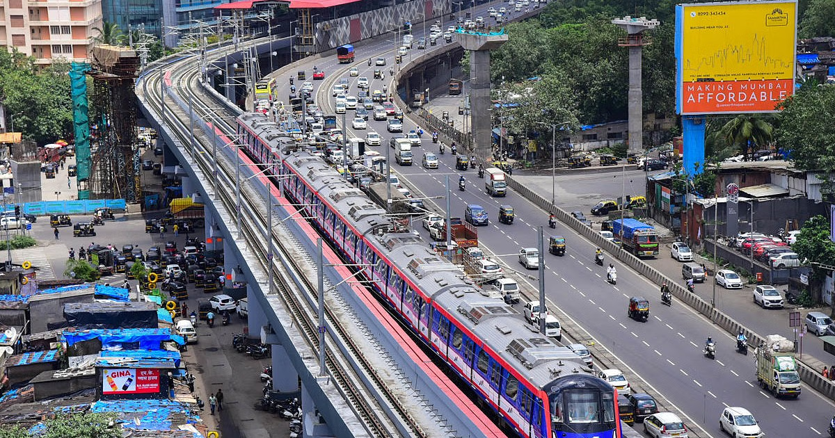
  • Upcoming Metro extension promises enhanced last-mile connectivity.

Planned Urban Ecosystem

  • The area is being developed with wider roads, green belts, commercial zones, and high-rise residential clusters.
  • Smart city elements, including rainwater harvesting, LED lighting, and underground utilities, are being integrated.

Residential and Commercial Boom

  • Major developers like DLF, Godrej, TATA Housing, ATS, and Shapoorji Pallonji have launched projects.
  • Properties range from mid-income to luxury housing, with average prices appreciating by 15–25% in the last two years.
  • The commercial segment, including retail and office space, is witnessing heightened demand due to population inflow.

Who’s Investing?

End-Users and NRI Buyers

  • Many Delhi-based families are relocating for better infrastructure and lifestyle.
  • NRI investors are considering this corridor due to rental yields and long-term value.

Corporate and IT Professionals

  • Close proximity to Cyber City, Udyog Vihar, and other commercial hubs makes it ideal for working professionals.
  • Co-living and co-working spaces are on the rise to cater to the growing millennial population.

Infrastructure Drivers

High-Speed Rail and Metro Expansion

  • The RRTS (Regional Rapid Transit System) and Dwarka Metro extension will further integrate this corridor into Delhi-NCR’s larger transport network.

Social Infrastructure

  • New schools, hospitals, malls, and entertainment hubs are emerging in the vicinity.
  • Emphasis on sustainable development, green spaces, and clean urban planning is boosting liveability.

Challenges to Watch

Regulatory Hurdles

  • Some land acquisition and construction clearances are still pending in a few zones.
  • Unified governance between Delhi and Haryana remains a challenge in some civic matters.

Affordability Factor

  • Rapid price rise is pushing certain segments beyond the reach of middle-income buyers.
  • Speculative investment may create artificial pricing bubbles if not regulated.

Future Outlook

Real estate experts predict that Dwarka Expressway will become the next Gurugram-like urban cluster, blending the best of city and suburban living. With improved transit, developer interest, and rising livability, the area is likely to remain a prime real estate destination for the next decade.


Dont Miss Out:

India Crosses 20 Lakh EV Sales in FY2025—A Clean Mobility Breakthrough

Metro Line 8 Approved: Mumbai & Navi Mumbai Airports to Be Linked by 2031!

Maharashtra Approves Metro Line 8 Linking Mumbai and Navi Mumbai Airports

Introduction

In a major infrastructure boost for Maharashtra, the state government has greenlit Metro Line 8, a dedicated corridor linking Mumbai’s Chhatrapati Shivaji Maharaj International Airport (CSMIA) to the upcoming Navi Mumbai International Airport (NMIA). This high-speed metro line will significantly reduce travel time between the two major air hubs, enhance passenger convenience, and catalyze regional development.

The project, to be spearheaded by CIDCO (City and Industrial Development Corporation), has been strategically approved to support the seamless integration of air and urban transit in one of India’s busiest metro regions.

Here’s everything you need to know about Metro Line 8 and its expected impact.

Key Highlights of Metro Line 8

Project Scope

  • Length: Approximately 35 km
  • Corridor: CSMIA (Mumbai Airport) to NMIA (Navi Mumbai Airport)
  • Estimated Cost: ₹15,000 crore
  • Travel Time: Expected to be under 30 minutes end-to-end

Construction & Timeline

  • CIDCO will manage the project execution.
  • Pre-construction work such as surveys and land acquisition is expected to begin in 2025.
  • Estimated completion by 2031, in sync with full operational capacity of NMIA.

Stations & Connectivity

  • Key stations to include BKC, Mankhurd, and Panvel.
  • Interchanges planned with existing metro and suburban railway lines for smooth integration.

Strategic Importance

Boost to Dual-Airport System

The Mumbai Metropolitan Region (MMR) will be among the few global regions with two international airports connected via a dedicated metro line, easing passenger transfers and boosting tourism.

Decongesting Road Traffic

Currently, travel between the two airports takes 1.5 to 2 hours by road. The metro line will offer a fast, reliable, and eco-friendly alternative.

Real Estate & Economic Growth

Enhanced connectivity is expected to spur real estate growth and commercial investments in Navi Mumbai, especially near station zones.

CIDCO’s Expansion Vision

Multi-Modal Integration

CIDCO plans to integrate Metro Line 8 with local buses, metro lines (like Line 2, 7, and Navi Mumbai Metro), and other transit nodes to ensure last-mile connectivity.

Smart Infrastructure Push

The project will feature state-of-the-art metro technology, energy-efficient systems, and smart ticketing platforms to align with global urban mobility standards.

Challenges Ahead

Land Acquisition & Funding

Acquiring land in densely populated zones and arranging large-scale funding could pose delays if not streamlined.

Environmental Clearances

The metro line’s alignment will require extensive environmental and urban development clearances due to its sensitive terrain.

Conclusion: A Game-Changer for Urban Mobility

The approval of Metro Line 8 is a visionary step toward transforming Maharashtra’s urban transport landscape. Connecting two major international airports through a fast and efficient metro corridor will not only ease travel for millions but also act as a catalyst for holistic regional development.

With CIDCO at the helm and government backing in place, Metro Line 8 holds the promise of becoming a flagship model of integrated urban mobility in India.


Dont Miss Out:

Siddhivinayak Metro Station Debuts With Stunning Architecture on Aqua Line

Siddhivinayak Metro Station Debuts With Stunning Architecture on Aqua Line

Siddhivinayak Metro Station Opens on Aqua Line—A New Landmark for Mumbai

Mumbai’s metro network just got a visual and infrastructural upgrade with the official opening of the Siddhivinayak Metro Station on the Aqua Line. Serving thousands of daily commuters and devotees visiting the iconic Siddhivinayak Temple, the station is already earning praise for its striking architectural design and spiritual elegance.

The launch offers a boost to both connectivity and civic pride, blending tradition with modernity in one of the city’s busiest corridors.

A First Look at the Design

Unlike typical metro stations, Siddhivinayak Station stuns with its aesthetic design inspired by temple motifs, clean structural symmetry, and open concourse. The interiors feature warm lighting, sleek finishes, and dedicated artwork reflecting Mumbai’s cultural essence.

Photos shared online reveal spacious platforms, well-marked signage, and intuitive commuter flow—all hallmarks of an upgraded metro experience.

Why This Station Matters

Located near the revered Siddhivinayak Temple, this metro station is poised to ease congestion on roads leading to the religious site, especially during festivals and weekends. It also:

  • Enhances last-mile connectivity for Dadar, Prabhadevi, and Worli
  • Offers a spiritual landmark within the city’s transit framework
  • Symbolizes a new phase of commuter-friendly metro design

Integration With the Aqua Line

The Aqua Line, part of Mumbai Metro’s Phase 2 expansion, runs through several densely populated zones, and Siddhivinayak is now one of its crown jewels. It aims to decongest road traffic while making urban transport more seamless, faster, and aesthetic.

The addition of Siddhivinayak Station also reflects a growing emphasis on design thinking in infrastructure projects—focusing not just on utility but also on user experience and visual appeal.

Public Response and Next Steps

Since images were first released, social media has buzzed with appreciation for the station’s modern architecture and thoughtful layout. Mumbaikars have lauded the city for finally building metro spaces that look and feel world-class.

Officials hint at more such artistically designed stations in the pipeline, with a focus on integrating functionality with beauty.

Conclusion – A Temple of Transit

The Siddhivinayak Metro Station is more than just a stop on the Aqua Line—it’s a symbol of Mumbai’s evolving identity. As the city continues to modernize its public transport systems, stations like this set a new standard for urban aesthetics and commuter care.

For citizens, it’s not just about getting from Point A to B—it’s about doing so in spaces that reflect pride, purpose, and beauty.


Dont Miss Out:

Dubai Tops 2024 Airport Rankings—World’s Busiest Again!

Dharavi Project Update: Unique IDs Rolled Out for 94K+ Residents

Dharavi Redevelopment: 94,500 Tenants Tagged with Unique IDs, 70,000 Homes Surveyed

Introduction

India’s most talked-about urban overhaul is making visible progress. Dharavi, Asia’s largest slum cluster, is undergoing a massive redevelopment initiative, and the latest update signals a major milestone. Authorities have assigned Unique Identification Numbers (UIDs) to over 94,500 tenants, while more than 70,000 homes have been surveyed as part of the first phase.

The Dharavi Redevelopment Project, helmed by the Adani Group in partnership with the Maharashtra government, aims to transform the area into a planned township with modern housing, commercial spaces, and improved infrastructure. It’s not just about new buildings—it’s about creating a sustainable and dignified future for lakhs of residents.

What Do the Unique IDs Mean?

The UIDs are Aadhaar-linked digital identifiers that help:

  • Validate tenant eligibility for free or subsidized housing
  • Prevent duplication and fraud during relocation
  • Ensure transparency in compensation and unit allocation

Each tenant will be tagged, mapped, and tracked through this centralized digital system, ensuring data accuracy and enabling faster decision-making.

Progress Report So Far

  • Total UIDs Issued: 94,500+
  • Homes Surveyed: 70,000+ structures mapped
  • Survey Work: Includes biometric verification, ownership proof, and structural conditions
  • Technology Use: Drones, GIS mapping, and digital forms

Officials say this data-driven approach is helping streamline planning and reduce manual errors that plagued earlier efforts.

Why This Matters

For decades, Dharavi’s redevelopment has remained stuck in bureaucratic red tape and logistical hurdles. This recent UID rollout signals a tangible start to a long-awaited transformation. Here’s why it’s significant:

  • Clarity: Residents now have proof of tenancy.
  • Security: UID-based systems can prevent displacement without rehabilitation.
  • Efficiency: Planning agencies can now fast-track housing layouts and infrastructure grids.

Resident Reactions

While many residents are hopeful, there’s a mix of skepticism too. Some worry about relocation timelines, size of allotted units, and whether livelihoods will be impacted. Authorities have promised:

  • Rental support during transition
  • Local business zones in the new development
  • Community consultation during planning phases

Looking Ahead

The next phase will include:

  • Finalizing layouts for new buildings
  • Allocation of transit accommodations
  • Demolition of unsafe structures
  • Launch of public-private construction efforts

Authorities plan to complete key groundwork by the end of 2025, with phased relocations to follow.

Conclusion

The Dharavi Redevelopment Project is finally moving from policy to action. The issuance of over 94,500 Unique IDs and the completion of more than 70,000 surveys mark a pivotal step toward turning one of Mumbai’s most densely populated informal settlements into a model of inclusive urban renewal.

With tech-enabled planning, Aadhaar-backed verification, and a structured approach, India might finally crack the Dharavi code—providing not just homes, but hope.


Dont Miss Out:


Jogeshwari Flyover Delay: 15 Years and Still Not Done?

Jogeshwari Flyover: 15 Years Later and Still Awaiting Completion

Introduction

In a city like Mumbai, where infrastructure is the lifeline of urban life, the prolonged delay of the Jogeshwari Flyover, officially known as the Balasaheb Thackeray Flyover, has become a textbook example of civic inefficiency and bureaucratic red tape. Conceived over 15 years ago to ease traffic congestion in the bustling suburb of Jogeshwari, the flyover remains partially incomplete even today. Residents, commuters, and local businesses have expressed increasing frustration as deadlines are repeatedly missed and the project continues to face hurdles. So, what went wrong? Why is the Jogeshwari Flyover still unfinished after a decade and a half? Let’s break down the timeline, key issues, and what lies ahead.


Why the Jogeshwari Flyover Remains Incomplete

Timeline of Delays

The construction of the Jogeshwari Flyover began in the mid-2000s with much fanfare and the promise of smooth, congestion-free commuting along the Western Express Highway. However, project timelines have been extended multiple times, with no clear end in sight.

Land Acquisition and Legal Battles

One of the main bottlenecks has been land acquisition issues, particularly involving private properties and religious structures. Legal disputes and compensation negotiations have significantly delayed the handover of crucial land segments to the project contractors.

Shifting Administrative Control

Frequent changes in governance — both political and administrative — have resulted in inconsistent project oversight. Each new leadership has brought with it revised priorities, leading to reallocation of funds and disrupted timelines.

Lack of Coordination Between Agencies

The flyover project has suffered from a lack of coordination between agencies like BMC, MMRDA, and PWD, often leading to overlapping responsibilities and blame games rather than focused execution.

Cost Overruns and Budget Constraints

Originally planned with a smaller budget, the project’s cost has ballooned due to inflation, delayed timelines, and poor resource management. This has resulted in stalled work at various stretches, including crucial connector ramps.


Impact on Daily Life and Urban Mobility

Traffic Nightmares

Commuters along the Jogeshwari corridor face daily congestion, detours, and longer travel times. The unfinished flyover often causes bottlenecks, defeating its original purpose.

Economic Losses for Local Businesses

Businesses along the construction site have seen a decline in foot traffic and revenue, with some even shutting down due to lack of accessibility and persistent noise and dust pollution.

Reduced Public Trust in Infrastructure Promises

Repeated delays have led to growing public skepticism about the government’s ability to deliver on urban development promises. Residents argue that if such an important corridor remains incomplete for 15 years, what hope is there for future infrastructure?


What Needs to Happen Next?

Clear Accountability and Timeline

A transparent project plan with updated timelines and assigned responsibilities is crucial. Holding agencies accountable will be the first step in restoring public confidence.

Dedicated Funding and Political Will

Allocating funds specifically for the project and ensuring political commitment can fast-track the pending work. Without focused attention, the flyover risks remaining in limbo for even longer.

Enhanced Inter-Agency Collaboration

Creating a joint task force involving all key stakeholders can help streamline execution, avoid overlap, and fast-track approvals for remaining works.


Conclusion

The Jogeshwari Flyover saga is more than just a delay — it’s a reflection of deeper systemic issues in urban infrastructure planning and execution in India. After 15 years of missed deadlines, ballooning costs, and civic frustration, the residents of Mumbai deserve better. If lessons are not learned from this debacle, it may not be the last time a vital project gets stuck in the quicksand of inefficiency. With proper oversight, accountability, and commitment, it’s still possible to bring this long-pending project to completion and finally deliver on the promise made over a decade ago.


Dont Miss Out:


Why Did CIDCO Navi Mumbai Scrap Land Deals Worth ₹2,000 Cr?

1.4 Cr People, 1.2 Cr Vehicles: Bengaluru Traffic Explained

Bengaluru Traffic Reaches Alarming Levels as Vehicles Nearly Match Population

Introduction:

Bengaluru, India’s bustling tech capital, is on the verge of a complete traffic meltdown. With a population of 1.4 crore and an astounding 1.2 crore registered vehicles, the Bengaluru traffic gridlock crisis is no longer a future possibility—it’s a daily nightmare.

Once lauded for its vibrant innovation hubs and cosmopolitan lifestyle, Bengaluru now battles some of the worst traffic congestion in the world. Civic planners, commuters, and government officials are grappling with the daunting challenge of decongesting a city where the number of vehicles is closing in on the number of people.

Bengaluru Traffic Gridlock: A Numbers Game Gone Wrong

Recent reports show that Bengaluru has over 1.2 crore vehicles on its roads—two-wheelers alone account for over 75 lakh. Cars, autos, cabs, and delivery vehicles clog every major junction during peak hours.

The data paints a grim picture:

  • Road length in the city: ~14,000 km
  • Vehicle density: ~900 vehicles per km
  • Average commute time: 2–3 hours per day

For many residents, daily life is dictated by traffic signals, long commutes, and endless delays.


Why Has the Bengaluru Traffic Gridlock Become So Severe?

Several interconnected factors have contributed to this crisis:

  • Inadequate public transport: Despite a growing metro network, last-mile connectivity remains poor.
  • Rapid urbanization: Migration from across India has outpaced infrastructure upgrades.
  • Unregulated vehicle growth: Easy vehicle loans and low entry barriers for ownership.
  • Narrow roads and bottlenecks: Legacy infrastructure not designed for today’s volume.
  • Poor enforcement: Encroachments, illegal parking, and signal jumping go unchecked.

The Bengaluru traffic gridlock is a classic case of infrastructure lagging behind urban growth.

Impact on Daily Life and Economy

The traffic crisis is taking a massive toll on quality of life and economic productivity:

  • Health hazards: Prolonged exposure to vehicular pollution
  • Mental stress: Anxiety, fatigue, and road rage incidents are on the rise
  • Fuel wastage: Thousands of liters wasted daily in traffic snarls
  • Logistics delays: E-commerce and delivery services are being severely affected

Many tech firms and corporates are now re-evaluating work-from-home policies to minimize commute times for employees.

Can Bengaluru’s Traffic Gridlock Be Fixed?

Experts suggest a mix of immediate and long-term interventions:

  • Massive public transport push: Expand metro lines, add more buses, and integrate with last-mile options like e-scooters and shuttles.
  • Carpooling incentives: Reward shared rides and restrict solo car use during peak hours.
  • Congestion pricing: Charge vehicles entering high-density zones.
  • Smart traffic systems: AI-based signal management and real-time monitoring.
  • Strict enforcement: Crack down on illegal parking and encroachments.

While multiple plans have been proposed, execution remains patchy and delayed.

Civic Response and Frustration

Public frustration is growing. Social media is filled with viral videos and memes of traffic jams lasting hours. Citizens are calling for:

  • Transparent urban mobility plans
  • Accountability from traffic police and BBMP
  • Faster completion of flyovers and underpasses

Citizen-led initiatives like car-free days and community rides are gaining traction, but they can’t solve the problem at scale.

Looking Ahead: Is There a Way Out?

The Bengaluru traffic gridlock won’t be resolved overnight. It requires coordinated action from state agencies, traffic authorities, urban planners, and citizens themselves.

If left unchecked, the city risks losing its appeal as India’s innovation hub. Infrastructure upgrades must match Bengaluru’s economic importance, and that means sustained investment, better planning, and bold reforms.

Conclusion: The growing Bengaluru traffic gridlock is more than just a mobility issue—it’s a symptom of an overstretched city struggling to catch up with its own success. With 1.2 crore vehicles battling for space among 1.4 crore people, Bengaluru must urgently reinvent its traffic and transport systems.

As the city stares down a potential gridlock collapse, it’s time for both policymakers and citizens to act—before the city comes to a complete standstill.


Dont Miss Out:

Zomato’s new AI tool ‘Nugget’ promises faster, smarter food deliveries… Learn more: